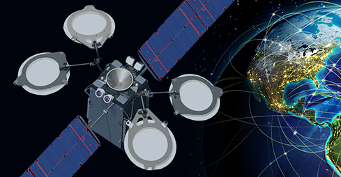
The Global Positioning System’s constellation of orbiting satellites is managed by the United States Air Force 50th Space Wing. The unit is the host wing at Schriever Air Force Base, located in east Colorado Springs, Colorado. They are responsible for tracking and maintaining the command and control, warning, navigational, and communications satellites for Air Force Space Command as well as the Global Positioning System satellites. Full Operational Capability was declared by NAVSTAR in April 1995 (NAVSTAR is an acronym for NAVigation Satellite Timing and Ranging, and is the official U.S. Government name given to the GPS satellite system).
The US government granted the Global Positioning System available for civilian use in the late 1980s and with no subscription fees or setup charges to use the GPS system the civilian GPS market exploded, especially in the last decade. A new generation of sophisticated GPS satellites are replacing the older satellites and there are now 34 GPS satellites in orbit that provide combat capability for military applications and aircraft navigation aids. Civilian applications include ATMs, bank and stock market transactions as well as power grid management. Currently 31 of the 34 GPS satellites in orbit transmit navigation and timing signals to civilian and military users around the world.
Gps for civilian use
The civilian GPS system wasn’t always as it is today and the US military is still keeping the most accurate Global Positioning Systems available classified for national security. But GPS upgrades for two new civilian signals to enhanced user accuracy and reliability, particularly with respect to aviation safety were planned in 1998. Then on May 2, 2000 “Selective Availability” was discontinued as a result of the 1996 executive order, allowing users to receive a non-degraded GPS signal globally, and in 2004 QUALCOMM announced the successful tests of assisted GPS for mobile phones that led the way for the GPS aided cell phones that are widely used today.
In 2005, the first third generation GPS satellite was launched and began transmitting a second civilian signal for enhanced user performance. Then in September of 2007 the Air Force completed a four-phase transition of the Global Positioning Systems ground segment to it’s new Architecture Evolution Plan. The ground segment’s provide command and control of the satellites and generates the navigation message for satellites to broadcast to the users GPS device to calculate their earth’s position. The new Gps satellites include new high-powered, anti-jam military-code, along with other accuracy, reliability, and data integrity improvements for both civil and military users. This modernized version of the world’s greatest free utility was designed to ensure the US has the most precise and secure positioning, navigation and timing capability through 2030.
Europe and Russia develop their own GPS
In 2004 the United States signed an agreement with the European Community establishing cooperation with Europe’s planned Galileo system. Galileo is a global navigation satellite system (GNSS) that is currently being built by the European Union and is separate from but complimentary to the United States Global Positioning System. The European Union’s Galileo system should be operational by 2013. The European Community’s political aim is to provide an independent GPS system that the European nations can rely on in times of war or political disagreement, because both Russia or the USA could disable use of their national systems by others (through encryption).
The Russian GPS system GLONASS is a radio-based satellite navigation system that was developed by the former Soviet Union and now operated for the Russian government by the Russian Space Forces. Like the European GPS system the Russian GPS system also functions separate from but is complimentary to the United States Global Positioning System. Russia began launching satellites for their GPS system into space on October 12, 1982 and was completed in 1995. The system rapidly fell into disrepair fallowing the collapse of the Russian economy but in 2001 the Russian government began restoring the system with hopes of restoring global coverage by the end of 2009.
GPS Systems today
Depending on the GPS unit a GPS receiver only needs a signal from 3-4 satellites to calculate the units position and will work in any weather conditions, anywhere in the world, 24 hours a day. There are no subscription fees or set up fees like with a cell phone to operate GPS receivers and although some GPS receivers have extra features like real time traffic updates that will have a monthly charge, some GPS receivers like Garmins Nuvi “T” series come with free live traffic for the life of the unit. Today’s GPS is extremely accurate thanks to their parallel multi-channel design. Garmin’s 12 parallel channel receivers are very quick to lock onto satellites when first turned on and they maintain a strong lock even in dense foliage or city’s with tall buildings because they continuously track signals from up to 12 satellites at any given time. Even if a 12 parallel channel GPS receiver loses signals from 8 satellites at once it will still function properly.
WAAS (Wide Area Augmentation System) was developed by the Federal Aviation Administration to augment the Global Positioning System to improve its accuracy, integrity, and availability. WAAS was originally intended to enable aircraft to rely on GPS for all phases of flight, including the precision approach to airport’s within its coverage area. All though originally intended for aviation most GPS receivers today are WAAS-enabled including automotive, boating chartplotters and hand-held units. WAAS uses a network of ground based reference stations, in North America and Hawaii, to measure small variations in the GPS satellites’ signals.